
Hiking The Abyss Trail in Nanaimo, BC
A local hike to one of Nanaimo’s strangest geological features

When I began my hike, I didn’t have any intention of visiting The Abyss. It’s a large crack in the ground, and I’d seen it plenty of times as a teenager. My real mission for the day was to track down some old coal mines in the area.
A few days before, I had been driving up Harewood Mines Road on my way to the Nanaimo Fish and Game Association. I hadn’t been up there in a while and was shocked by the amount of clear-cut logging that had recently taken place. When I was in high school, this area was densely forested. The thick canopy of trees protected the nearby secrets...
A car graveyard, numerous coal mines, and, of course, “The Abyss”.
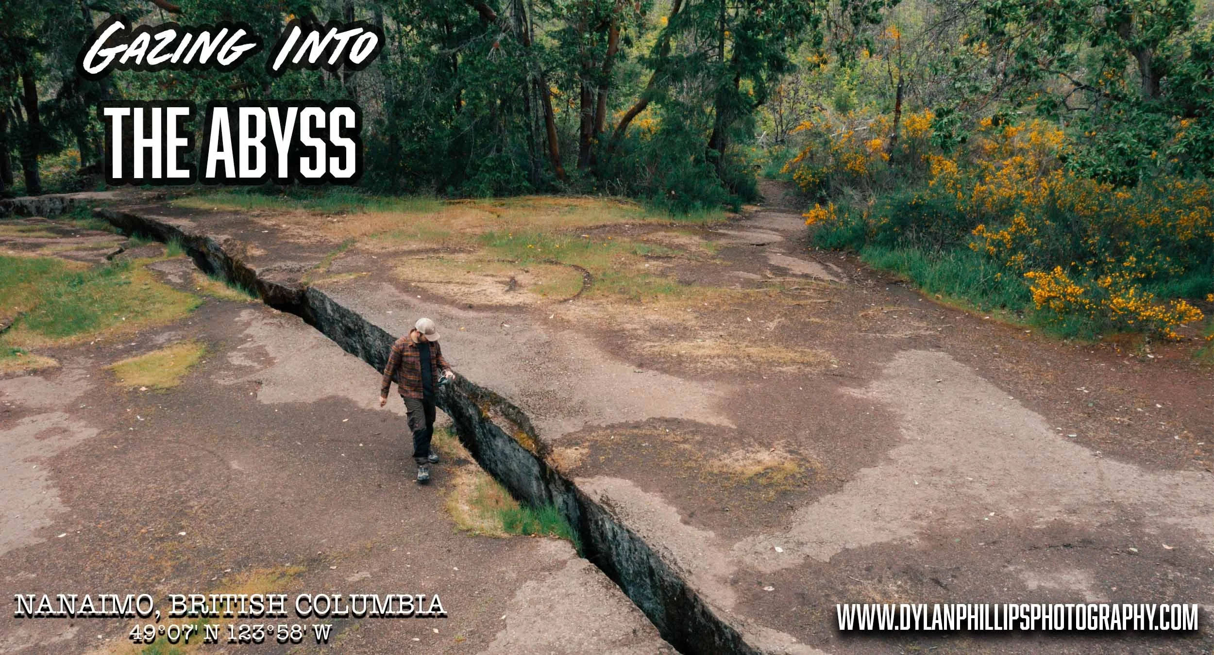
“What is the Abyss?” you ask? Well, it’s a large crevice on top of Extension Ridge. Though the name is probably unofficial, Us locals have been calling it the Abyss for as long as I can remember.
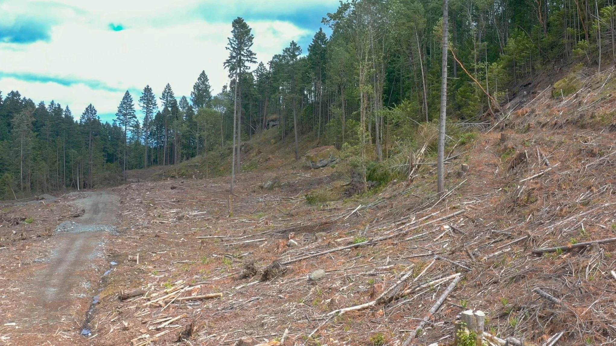
Rainforest Devastation courtesy of Mosaic Land Management - Dylan Phillips Photography
Searching for Nanaimo’s Coal Mining History
It had been many years since I last hiked around the area and even longer since I’d trekked out to the old coal mines. Realizing the devastation of the forest might allow me to better explore for mines and caves, I packed a bag and laced up my boots.
It wasn’t long before I was standing in the ruins of a once beautiful forest. I could see right up to the old mine, a heap of coal ore marking the spot. This was hidden from the road for decades and now it was staring me in the face. I began making my way up ridge.
The mine has its own historic value, though it’s something I’m saving for a future post. It was as I remembered it – Sealed up tight. I took some photos before scrambling along the ridge face looking for more evidence of mines or caves. It wasn’t long before I found myself on top of the ridge.
Rumours of The Abyss
There’s a lot of speculation as to whether the Abyss is caused by seismic activity or has something to do with the blasting that took place in the coal mine below. Like anything mysterious there is many rumours and stories connected to the Abyss.
“It has no bottom” - Not true.
”It’s connected to the mine tunnels” - Probably not true, and if it were, you’d have to be a moron to attempt the journey.
Approaching The Abyss
I followed the dirt path towards the Abyss for the first time in over a decade. As I got closer I started to encounter warning signs put up by the Regional District of Nanaimo
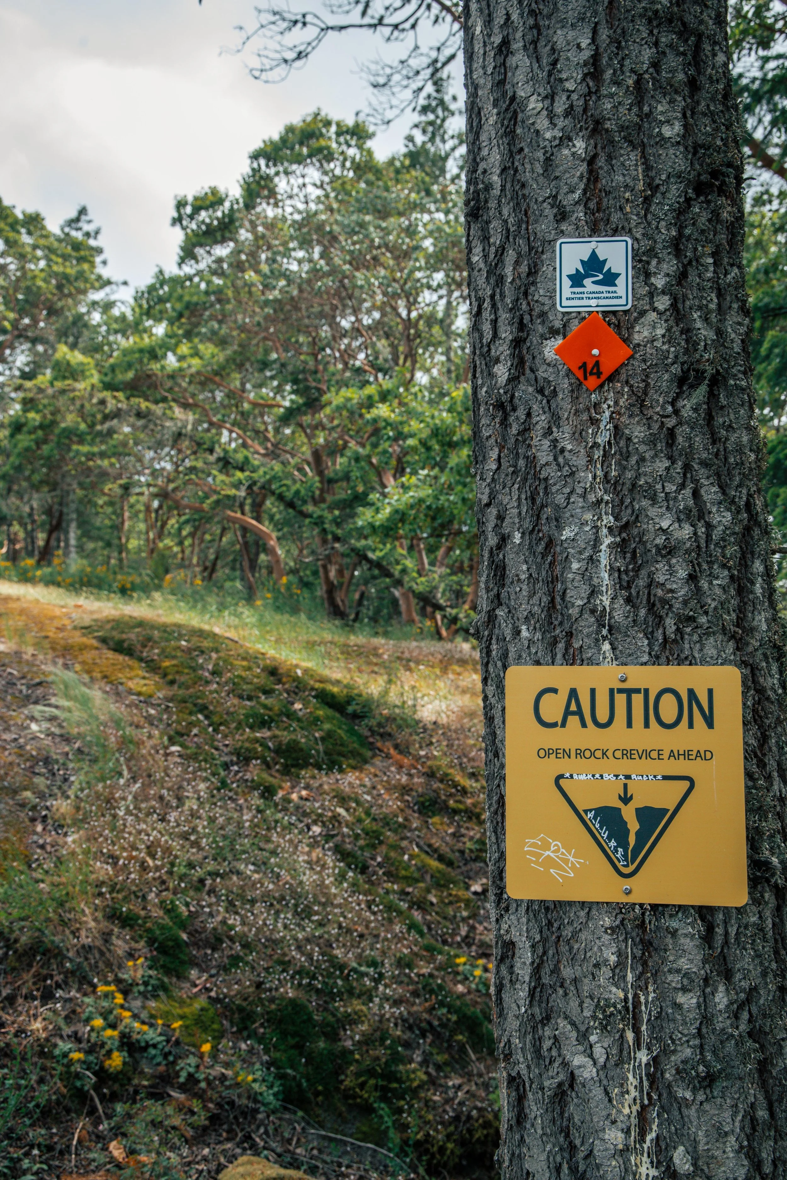
Caution signs posted near the Abyss, Nanaimo Regional District
It’s interesting how liability and lawsuit change our world so rapidly. This amazing geological feature used to be just a crack in the ground. Eventually it gained notoriety on the internet and became a popular hiking destination. How long now until they fence it off and build a viewing platform? That sad truth gets closer to being reality every time Search and Rescue is dispatched to save someone’s dog that’s fallen in.
Side note: *Keep your dogs, children, arms, legs, friends and lucky lager cans outside of the giant crack in the ground*
Show off your wild side with a Wild Portrait Experience
Love places like this?
I photograph people in the wild landscapes of Vancouver Island, creating portraits that feel adventurous, cinematic, and real.
Photographing The Abyss
While I approached the Abyss it dawned on me that I had been seeing a lot of posts on social media lately. None of them had really captured the magnificence of it. Armed with my usual tools for photography, I decided to take a crack at really doing it justice.
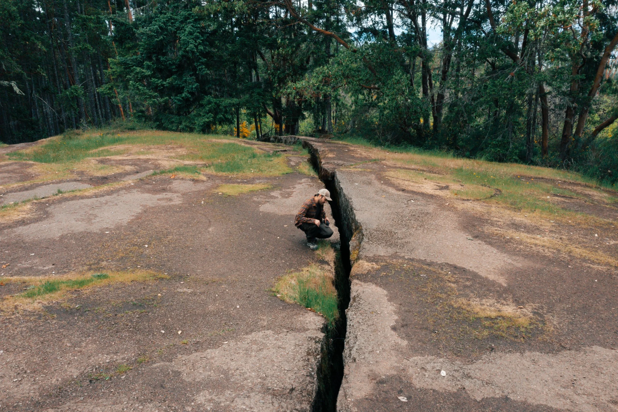
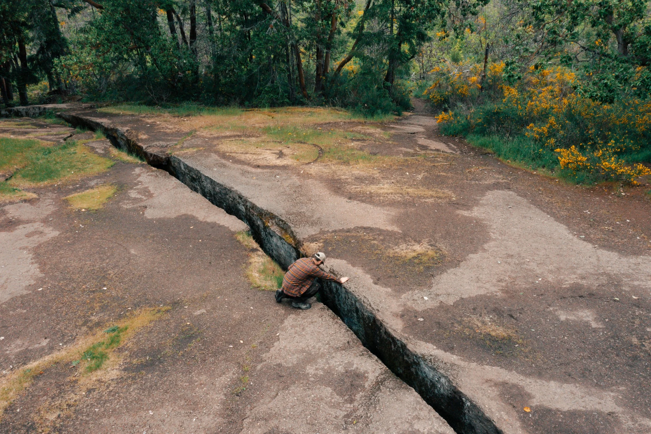
The Abyss. Nanaimo Regional District
Hiking by myself, I once again had to be my own model. I think having a person in the photos is essential to add a sense of scale to the feature. This is something I’ve learned after years of waiting for people to move or leave – Sometimes it’s better to have people in your shot.
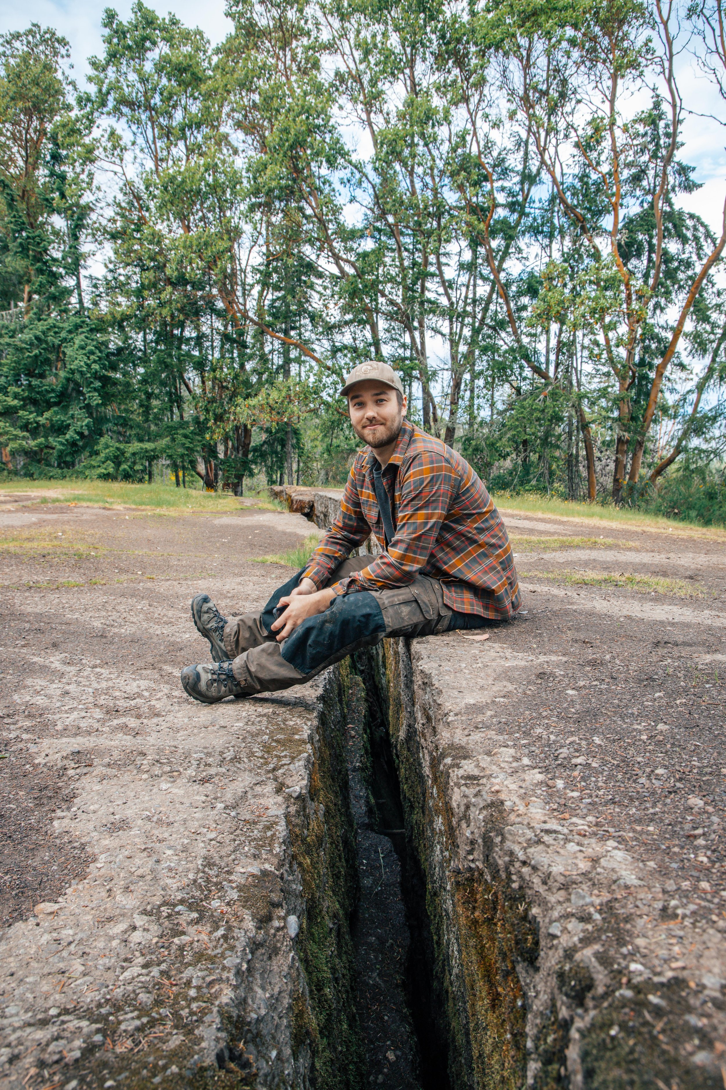
The Abyss, Nanaimo Regional District
I used my DJI Mavic 2 Pro on a timer to capture some fresh angles while I peered into the darkness. After landing the drone I pulled out a proper camera and my Peak Design Travel Tripod (Not a paid partnership, I just love this thing!) and snapped some shots from a lower angle.
Perched on the ledge of The Abyss, Nanaimo Regional District
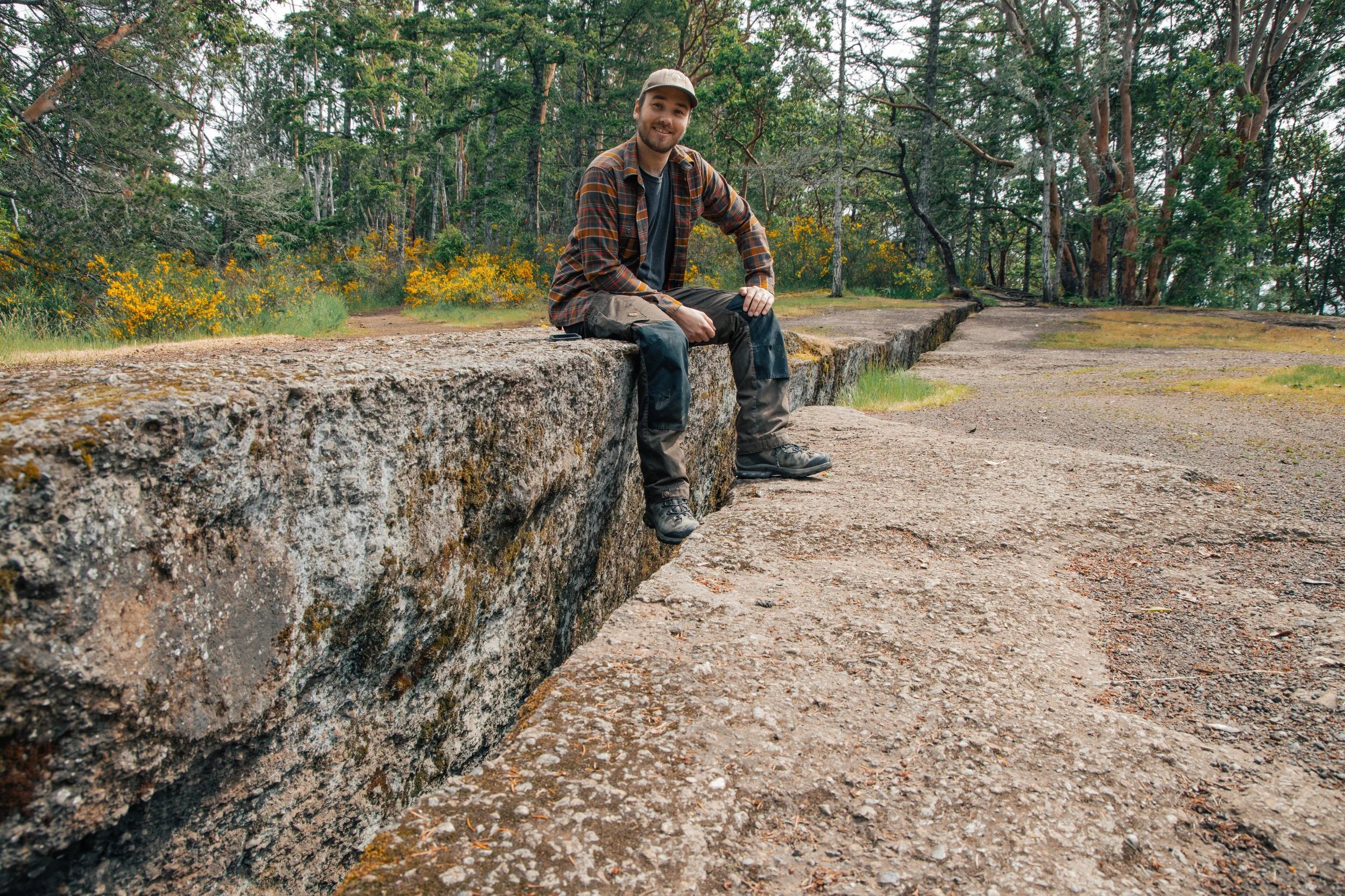
Dylan Phillips Photography
Why This Spot Photographs So Well
One of my favourite details out there is the way the arbutus trees line the ridge. I was always told that they’re protected and the loggers have to leave them when they’re harvesting (read destroying) the forests. They’re a very unique feature that’s always made hiking on Vancouver Island feel a bit more magical.
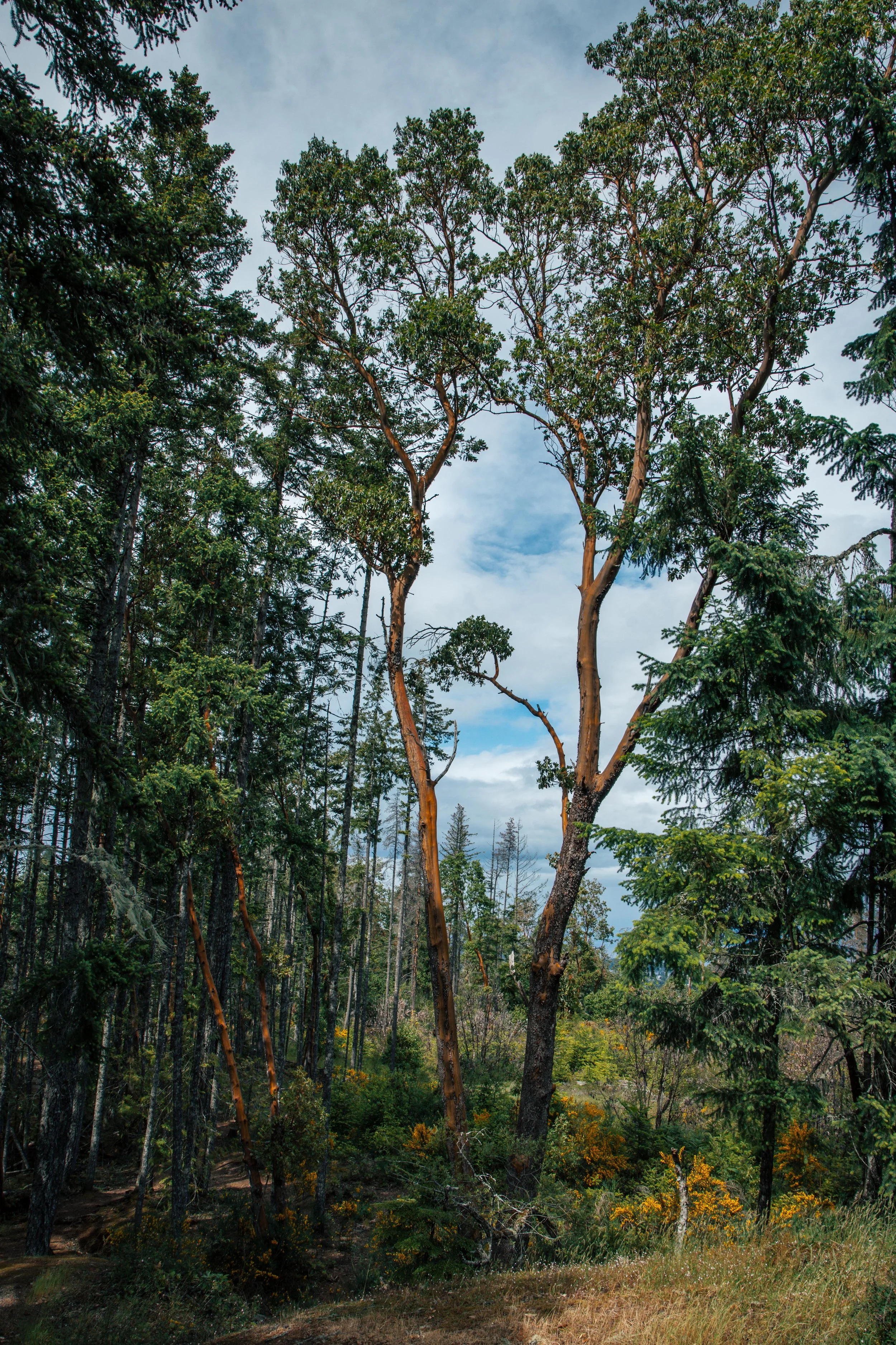
Arbutus Trees on Extension Ridge
Looking for some wall art? Browse my favourite images in my Print shop!
Feeling satisfied with my photo attempts, I had a quick snack and a drink of water before setting off farther down the ridge. I was able to scramble my way down and find my way onto a mountain biking trail that eventually led me to another old mine. I had been in this one several times when I was young and dumb. Now wiser to the dangers of H2S and cave-ins, I viewed it from the outside before heading back to the road.
If you come across an old coal mine in the hills around Nanaimo, that’s the approach I’d recommend.
Visiting The Abyss: Tips and Etiquette
The Abyss is a short hike with a moderate incline. Access from Harewood Mines Road near the power lines.
A few things are worth keeping in mind before you go:
Stay well back from the edge, especially in wet weather.
Keep dogs and kids close.
Respect posted signage and the surrounding trail network.
Do not enter old mine openings.
Pack out what you pack in and leave the area better than you found it.
Final Thoughts
The Abyss is one of those places that makes Nanaimo interesting. We’re fortunate to have an abundance of history and mystery and its all just a hike away.
That’s a big part of why I keep exploring and photographing Vancouver Island. Even these well known places still have the power to surprise you.
”And if you gaze for long into an abyss, the abyss gazes also into you.”
- Friedrich Nietzsche
You may also enjoy:
Capture Your Own Vancouver Island Story
Exploring places like The Abyss reminds me why I love photographing on Vancouver Island. Every ridge, forest trail, and hidden landmark has its own atmosphere and story. If this kind of place speaks to you, let’s plan a Wild Portrait Session together. I’ll help you choose a location that feels true to you and create images with a real sense of adventure.
“Rising above the forest near South Wellington, the headframe at Morden Colliery is one of the last visible relics of Vancouver Island’s coal mining era. In this post, Vancouver Island photographer Dylan Phillips explores the history of the mine, the tragedy that struck here in 1912, and his own connection to one of the island’s most haunting industrial landmarks.”